Fail ini dari Wikimedia Commons dan mungkin digunakan oleh projek lain.
Penerangan pada laman penerangan failnya di sana ditunjukkan di bawah.
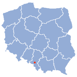
Ringkasan
File:POL Żory map.svg merupakan versi vektor bagi fail ini. Ia sepatutnya digunakan bagi menggantikan imej raster ini apabila ia mempunyai peleraian yang lebih besar dan lebih baik.
Copyright notice: Image made by Halibutt and uploaded to Wikipedia by the author. Images can be made available for use under other copyleft licenses on a case by case basis via direct contact with the author. Under moral rightsthe user requires that this work be properly attributed to its creator. For photographs, this is traditionally done in the image caption. Where a copyright notice is present, using the copyright notice in the caption will be sufficient. Note that the GFDL requires that any copyright notices be included with the work even when making unmodified use of it.
Since the legal status of the above comment has been questioned, I hereby grant anyone the right to treat it as either a standard copyright notice, invariant section, legal statement, legal advice, friendly suggestion or a mere comment, depending on his or hers own choice.
Kebenaran diberikan untuk menyalin, mengedar dan/atau mengubah dokumen ini di bawah syarat-syarat Lesen Pendokumenan Bebas GNU, versi 1.2 atau mana-mana versi selepas ini, yang diterbitkan oleh Yayasan Perisian Bebas; tanpa Seksyen yang Tak Berubah, tanpa Teks Kulit Depan dan tanpa Teks Kulit Belakang. Salinan lesen ini boleh didapati dalam seksyen yang bertajuk Lesen Pendokumenan Bebas GNU".http://www.gnu.org/copyleft/fdl.htmlGFDLGNU Free Documentation Licensetruetrue
untuk berkongsi – untuk menyalin, mengedar dan memindah hasil kerja
untuk mencampur semula – untuk menyesuaikan karya
Di bawah syarat berikut:
pengiktirafan – Anda mesti memberi penghargaan yang berpatutan, bekalkan pautan ke lesen, dan tunjukkan jika perubahan telah dibuat. Anda boleh lakukannya dalam sebarang cara yang munasabah, tetapi bukan dalam sebarang cara yang mencadangkan pemberi lesen mengendors anda atau penggunaan anda.
perkongsian serupa – Jika anda mengubah, adun semula, atau menokok tambah bahan, anda mesti menyebarkan sumbangan anda di bawah lesen yang sama atau serasi dengan yang asal.
Tag pelesenan ini dibubuh pada fail ini sebagai sebahagian kemas kini pelesenan GFDLhttp://creativecommons.org/licenses/by-sa/3.0/CC BY-SA 3.0Creative Commons Attribution-Share Alike 3.0truetrue
Captions
Add a one-line explanation of what this file represents


